History and Culture of American Samoa
From before regular contact with Europeans until today, American Samoans have worked hard to preserve the Fa’amatai or Fa’a Samoa (the Samoan Way). This system of cultural and moral values is part of American Samoa’s Polynesian heritage dating back to around 1000 BCE, when the Samoan Islands are believed to have been first settled by expert seafarers of the Lapita culture from the nearby Tongan islands. These first settlers brought with them pottery, fishing tools, and domesticated plants and animals. Samoans on Tutuila later exported various items to neighboring islands, including basalt from several quarries around the island.
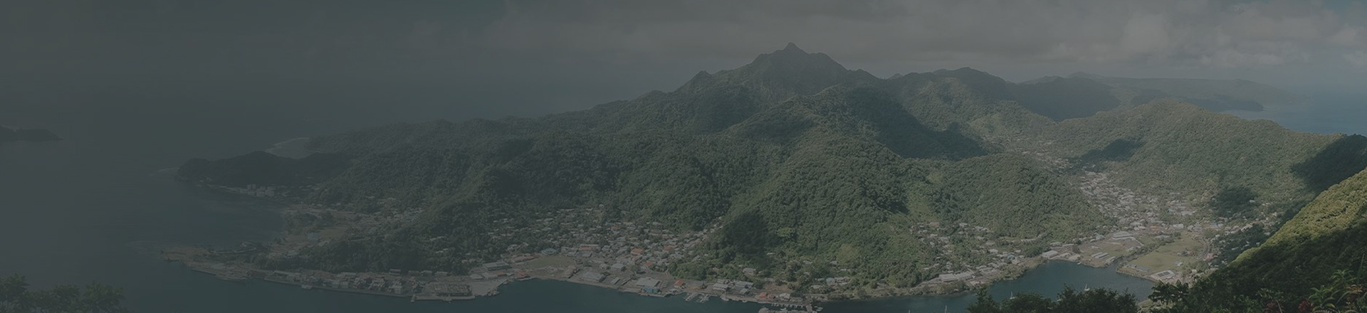
Over time, Samoans settled in villages, many of which are still inhabited today. A typical village has open structures to accommodate communal gatherings and other meetings. Today, innumerable open-air meeting houses, resembling wooden or thatched gazebos, dot the landscape all over American Samoa. These structures, known as fales, accommodate chief council meetings, family meetings, funerals, and other kinds of ceremonies. Areas in front of the fales, called the malae, carry cultural importance as meeting places and are usually kept clear as grassy or sandy areas. Older fales were typically circular or rounded, although more recently they have become rectangular in shape. All are an interesting and unique part of island culture.
It is believed that Jacob Roggeveen, a Dutch explorer, became the first European to encounter the islands in 1722. In 1830, missionaries from the United Kingdom began arriving, and over the years Christianity became a very important fixture of American Samoan life.
Territory
Outside influence increased dramatically in the late 1800s. In 1878, the U.S. signed a treaty to establish a naval presence in Pago Pago Harbor as foreign business interests and Western nationals began to interfere in local governance, which combined with Samoan factional conflict to cause heightened tensions and low-intensity violence. In 1899, hoping to head off civil war in Samoa, Germany, Britain, and the United States signed the Tripartite Convention with little input from native Samoans. The settlement assigned colonial control of Western Samoa (now simply known as the independent nation Samoa) to Germany and the eastern islands (now American Samoa) to the United States. The islands of American Samoa then became a U.S. territory in 1900 through a voluntary deed of cession. This event is now annually celebrated in the territory as Flag Day.
The territory was governed and administered by the U.S. Navy from 1900 to 1951 and served as a warship supply station. In 1918, the naval governor took decisive action to enforce a strict quarantine that kept the territory one of only a handful of places on Earth to escape the influenza pandemic. A similar approach was taken in 2020 in response to the COVID-19 pandemic, making American Samoa one of the only COVID-free U.S. states or territories. During World War II, the Navy constructed a number of facilities and fortifications around the islands. Many of these structures survive to this day, including pillboxes at the entrance to Pago Pago Harbor and scattered along Tutuila’s coast.
After 1951, it became apparent that American Samoa had lost its military importance and the U.S. Department of the Interior’s Insular Affairs Office took over administrative responsibility. Since that time, American Samoa has come to be increasingly influenced by American cultural and economic forces. For example, Tutuila has a national park (the National Park of American Samoa)and has businesses affiliated with American mainland employers, the most prominent being Starkist Tuna. However, it remains an “unorganized” and “unincorporated” territory. American Samoa’s status as “unorganized” means that Congress has not passed an Organic Act to create American Samoa or the American Samoa Government. Its status as “unincorporated” means that the full range of federal law and constitutional protections are not incorporated into the territory’s legal system. The Department of the Interior allowed American Samoa to draft and adopt its own constitution in 1967, although it was not until 1977 that American Samoans were permitted to elect their own governor.
The people of American Samoa today are dedicated to their heritage, families, and way of life. Yet, despite their traditional outlook, American Samoa is a warm, kind, and welcoming place to visit for the fortunate outsiders who reach this place.
For more information on American Samoa history and culture, try these resources:
American Samoa Historic Preservation Office
Executive Offices of the Governor
Pago Pago, AS 96799
T: 684-699-2316
F: 684-699-2276
Website
Facebook
Jean P. Haydon Museum
Main Road, Fagatogo
Pago Pago, AS 96799
684-633-4347
Wikipedia